Tasmania Driving Times and Distances for Cars and Campervans
It’s a small island, but Tasmania driving times and distances can be deceptive. Use our ‘Driving Time Calculator’ to plan your Tasmanian road trip the right way!
This page contains affiliate links. If you book or buy something through one of these links, we may earn a small commission (at no extra cost to you!). Read our full disclosure policy here.
When visiting a holiday destination for the first time it is easy to misjudge the time it takes to drive between towns.
To make your planning easy we’ve created easy-to-follow road trip itineraries that guide you from place to place, ensuring you never run short of time or miscalculate the distance.
But of course, whether it’s by hire car or by campervan, planning your own Tasmanian road trip itinerary is half the fun!
To help you out, we’ve put this guide together to give you a good feel for how long it takes to drive between the major destination along the Lap of Tasmania road trip route, and to tell you more about the Tasmanian quirks that can cause unexpected delays on the road.
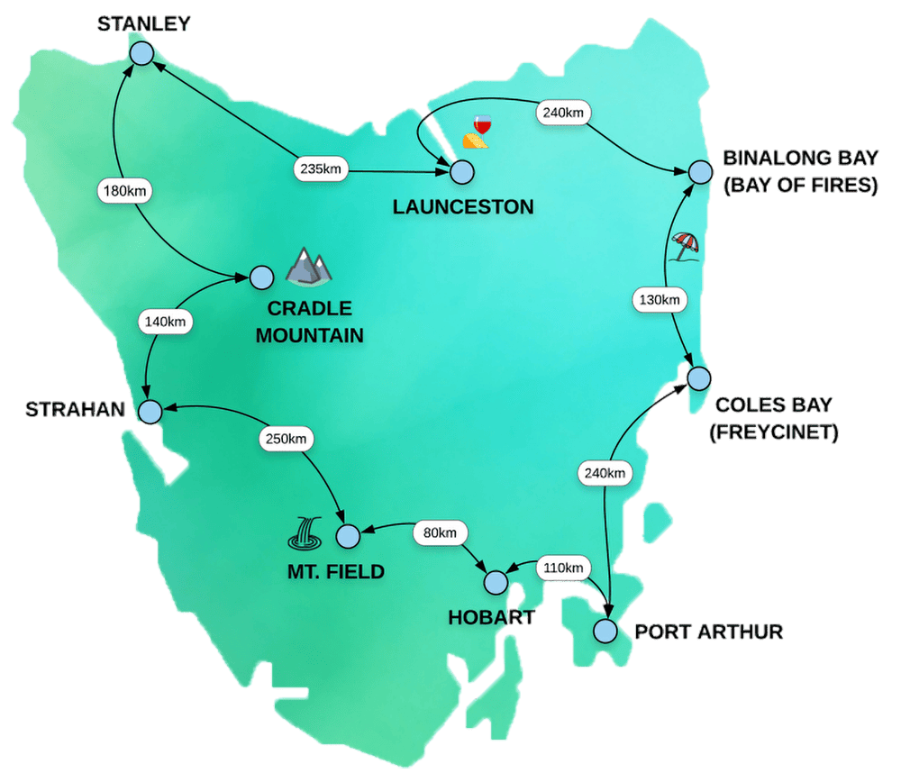
Before you start you might like to have a look at this Tasmania map. Distances are shown to give you a feel for how far you need to drive.
Tasmanian ‘Driving Time Calculator’
The table below lists all the major destinations along the route of the Lap of Tasmania at which you might want to spend a night or two.
Simply type in the town you’re interested in and it will filter the results to show you all the different options To/From that town.
Note: The times quoted here assume non-stop driving. Don’t forget to allow for additional time for photo stops, meals and rest breaks.
| From | To | Distance | Car | Motorhome |
|---|---|---|---|---|
| Beauty Point | Low Head | 45km | 40mins | 45mins |
| Bridport | Derby | 55km | 50mins | 1hr |
| Coles Bay | Port Arthur | 240km | 3hrs | 4hrs |
| Cradle Mountain Village | Launceston (via Stanley and Sheffield) | 410km | 5hr 40mins | 7hrs+ |
| Cradle Mountain Village | Stanley | 170km | 2hr 30mins | 3hrs |
| Derby | St Helens | 65km | 1hr 10mins | 1hr 30mins |
| Derwent Bridge | Strahan | 130km | 2hrs | 3hrs |
| Devonport | Launceston | 105km | 1hr 20mins | 1hr 30mins |
| Devonport | Sheffield | 30km | 30mins | 40mins |
| Devonport | Strahan (via Queenstown) | 220km | 3hr 15mins | 5hrs |
| Hobart | Bay of Fires (Binalong Bay) | 265km | 4hrs | 5hrs |
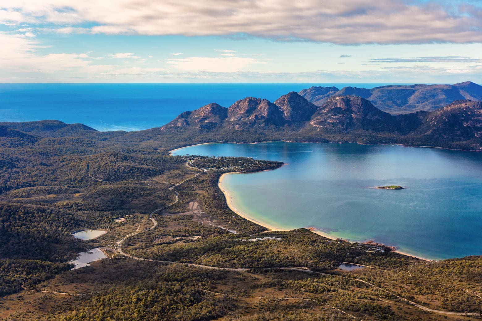
| Hobart | Coles Bay | 200km | 2hr 30mins | 4hrs |
| Hobart | Derwent Bridge | 175km | 2hr 30mins | 4hrs |
| Hobart | Devonport | 280km | 3hr 15mins | 4hrs |
| Hobart | Launceston | 200km | 2hr 30mins | 3hrs |
| Hobart | Mt Field | 80km | 1hr 15mins | 1hr 45mins |
| Hobart | New Norfolk | 35km | 40mins | 45mins |
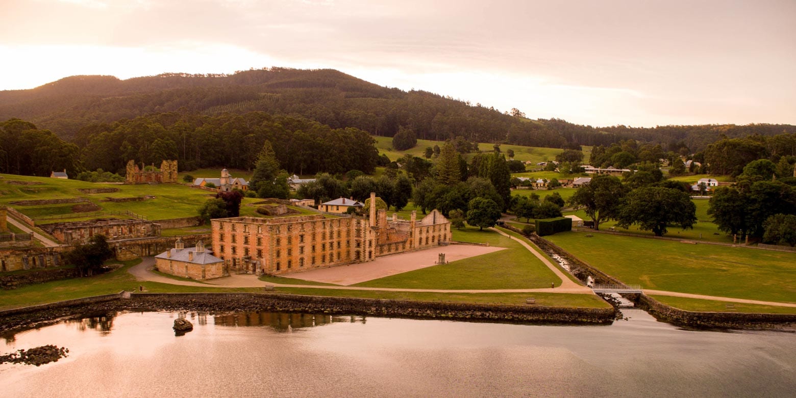
| Hobart | Port Arthur | 100km | 1hr 30mins | 2hr 15mins |
| Hobart | Richmond | 25km | 30mins | 40mins |
| Hobart | Strahan (direct) | 300km | 4hr 30mins | 6hrs+ |
| Hobart | Strahan (via Mt Field) | 360km | 5hr 15mins | 7hrs+ |
| Launceston | Beauty Point | 50km | 45mins | 1hr |
| Launceston | Binalong Bay (via Batman Bridge, Bridport and Derby) | 240km | 3hr 15mins | 4hrs |
| Launceston | Bridport (via Batman Bridge) | 110km | 1hr 30mins | 1hr 45mins |
| Launceston | Cradle Mountain Village (via Sheffield) | 140km | 2hrs | 2hr 30 mins |
| Launceston | Derby | 160km | 2hr 15mins | 2hr 45mins |
| Low Head | Bridport | 60km | 45mins | 60mins |
| Mt Field | Derwent Bridge (via Hamilton) | 150km | 2hrs | 3hrs |
| New Norfolk | Mt Field | 40km | 45mins | 1hr |
| Port Arthur | Richmond | 80km | 1hr 15mins | 1hr 45mins |
| Port Arthur | Swansea | 180km | 2hr 30mins | 3hr 30mins |
| Richmond | Coles Bay | 170km | 2hr 15mins | 2hr 45mins |
| Richmond | Triabunna | 65km | 50mins | 1hr 15mins |
| St Helens | Bicheno | 75km | 1hr | 1hr 15mins |
| St Helens | Binalong Bay (Bay of Fires) | 12km | 15mins | 20mins |
| St Helens | Coles Bay | 115km | 1hr 30mins | 2hrs |
| Stanley | Devonport | 125km | 1hr 30mins | 1hr 45mins |
| Strahan | Cradle Mountain Village | 140km | 2hrs | 2hr 30mins |
| Strahan | Queenstown | 42km | 45mins | 1hr |
Things to know about Tasmania driving times and distances
Mountainous terrain
Tasmania is a small island, but sometimes you will need to allow extra travel time due to the mountainous terrain.
Slower speeds are often necessary to tackle steep and windy sections – both up and down – and you may get stuck behind slow moving vehicles like log trucks, caravans or campervans.
We have allowed for these mountainous sections in our custom itineraries and in the Driving Distance Calculator (above) – but if you’re creating your own road trip route then do keep this in mind.
Parts of the ‘Lap of Tasmania’ route where there is more likely to occur include:
Derwent Valley [more] – The upper valley, between Wayatinah and Derwent Bridge on the Lyell Highway (A10).
West Coast [more] – The ’99 Bends’ on the Lyell Highway (A10) between Derwent Bridge and Queenstown, and then from Queenstown through to Strahan.
Cradle Coast [more] – The Murchison Highway (A10) from Parrawe down into Hellyer Gorge and through to Oonah.
North East Tasmania [more] – The Tasman Highway (A3) from Derby up to Pyengana, over the pass and down to Goulds Country.
East Coast [more] – A short section of the Tasman Highway (A3) between Orford and Buckland, and another up near Bust Me Gall Creek (yes, that’s a real place!) between Buckland and Orielton.
Tasman Peninsula [more] – Nearly the entire length of the Arthur Highway (A9) beyond Forcett is slow going, to Dunalley and Eaglehawk Neck, and then through to Port Arthur.D
Tasmanian weather – Snow, ice, wind and fire
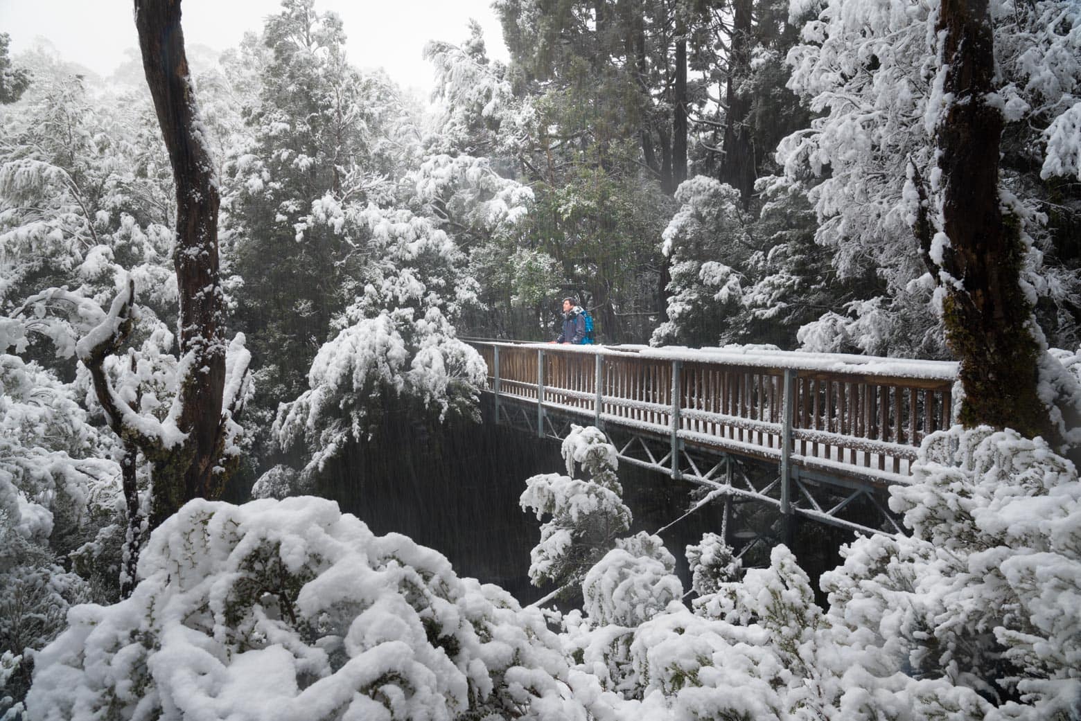
Snow
As you’ve probably heard, Tasmania’s weather is unpredictable and can change from bright sunshine to Antarctic storms in less than an hour.
There’s no need to worry though, as most road trippers end up having the time of their life without any disruptions at all – but it’s best to be prepared.
>> Find Out the Best Time to visit Tasmania <<
Snow is most likely during winter but can occur at any time of the year – however road closures along the route aren’t common. If snow is forecast you can check alerts on the Tasmania Police website.
While unlikely, you may encounter short road closures at:
- Mt Wellington (near Hobart) – The road to the summit experiences a few closures every year.
- Mt Field (Derwent Valley) – Access to the Visitor Centre (and Russell Falls) is always open, but the gravel road up to Lake Dobson and Tarn Shelf occasionally experiences closures.
- King William Saddle (near Derwent Bridge) – The road between Derwent Bridge and Strahan is at 800m and occasionally gets a big dump of snow.
- Cradle Mountain Road – The main access road to Cradle Mountain Village does get closed occasionally, but it is also one of the highest priority roads to be cleared after snow falls.
- Belvoir Road (between Cradle Mountain and Waratah)
- Mt Murchison (West Coast) – The Murchison Highway experiences occasional closures in the vicinity of Mt Murchison.
- Great Lakes and Central Highlands – This region gets more snow than most other parts of Tasmania, but less travellers as well.
Ice
A hidden danger on some of Tasmania’s roads is black ice. During the day it is rare for temperatures to fall below 0 degrees Celsius, but in the early hours of the morning it can get cold enough for ice to form.
Ice can occur at any time of the year, but is most common during the cold, dry conditions often experienced in autumn and winter.
If you suspect there might be ice on the roads then either defer your driving until the sun has a chance to melt the ice, or drive a lot slower and with more care than usual.
Wind
Wind squalls are common across Tasmania – gusts can approach 100km/hr – and if you’re driving a campervan or caravan you’ll need to slow down. Our best advice is to keep an eye on the Bureau of Meteorology website for storm warnings.
Fire
Bushfires occur every year in late spring, summer and early autumn and sometimes result in road closures. Check the Tasmania Fire Service Alerts Map for the latest information.
Wildlife after dark
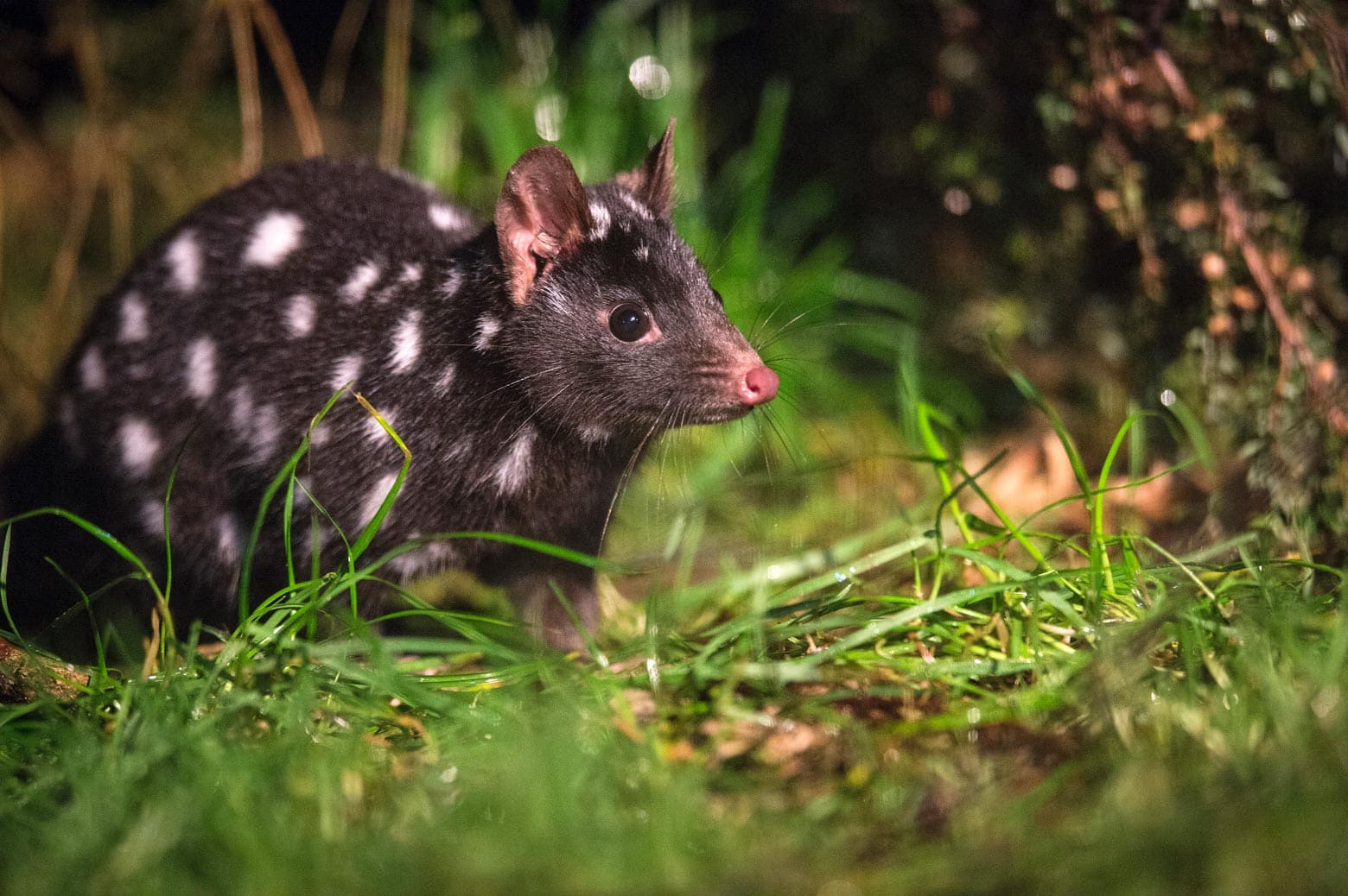
Tasmania is covered in dense forests, making it a haven after dark for nocturnal wildlife like Tasmanian devils and possums. Wallabies and bandicoots also love to graze on the grasses by the side of the road at dawn and dusk.
>> The Best Place to See Tasmanian Devils <<
We recommend planning your road trip itinerary to avoid night driving, but if this is’t possible then slow down by 20km/hr – even more in thickly wooded areas or where there are blind corners – and use your high beam lights wherever it is sensible.
Campervans and caravans
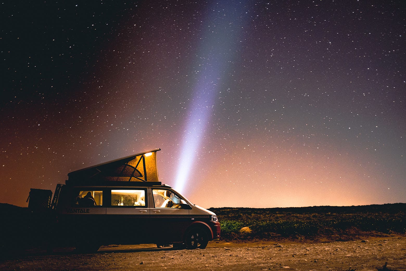
We’ve noticed that other websites often only show travel times for cars. If you’re doing your Lap of Tasmania in a motorhome or caravan then we recommend adding 20% onto any ‘car’ driving times.
If you’re still looking for the best rental campervan or motorhome you’ll love our guide!
>> Read our Campervan Hire Guide <<
We often get questions from travellers wondering if a certain road is driveable with a 22ft or larger caravan in tow.
Some roads may need to be driven a little slower than usual, but all of Tasmania’s sealed roads are completely fine for caravanners or motorhome drivers.
Road works and road closures
Road closures are rare along the Lap of Tasmania route, but it’s worth a quick check of the Tasmania Police website before you leave each morning.
The Midlands Highway is a ‘special’ case. It doesn’t form part of the official Lap of Tasmania route, but it is the main road between Hobart and Launceston and it is in a constant state of upgrade or repair. If you find yourself at the pub, ask a local for their thoughts on the matter…
Delays normally aren’t too long, but expect to stop a few times along the way. Again, check the Tasmania Police site for more details.
Ferry schedules
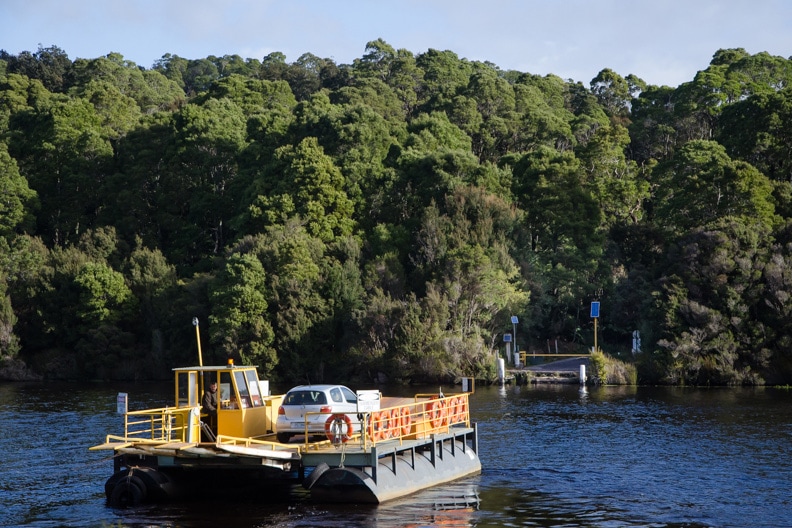
If you are planning on visiting Bruny Island or Corinna (from the southern side) then you will need to allow time in your itinerary to line up with the ferry schedule.
Click here to check the Bruny Island ferry schedule.
Click here to check the Corinna ‘Fatman’ barge schedule.
Common questions
We see a lot of questions being asked online about travel times and driving times in Tasmania, so we thought we’d put them in one place so you’ve got all the information you need to plan your Tassie road trip.
How long does it take to drive around Tasmania?
We don’t recommend it, but you could drive around Tasmania in as little as 3 days. But you’d be an absolute wreck at the end, and probably more stressed than when you started!
Working out how long to drive around Tasmania depends on your road trip route, how long you’d like to spend in each destination, and how much driving you’d like to do each day.
The Lap of Tasmania route [map] is around 1,500km long, and we feel that you should allow at least 7 days (this itinerary shows you how).
Ideally, we recommend 14 days or more to drive around Tasmania (especially if you are in a caravan).
This lets you stay in iconic locations for at least a couple of nights, gives you enough time to see the ‘Big 12‘, and opens up the option of extending down into the Huon Valley, exploring the Highlands, or doing day-trips to Bruny Island or Maria Island.
What is the distance from Launceston to Hobart?
The distance from Launceston to Hobart is 200km (124 miles) along the Midlands Highway.
We recommend allowing 2 hours 30 minutes by car, or 3 hours in a campervan or motorhome, to drive between the two cities.
As we mention above, road works are ongoing on the Midlands Highway and short delays are not uncommon.
How long does it take to drive from Hobart to Port Arthur?
It takes around 1 hour 30 minutes to drive from Hobart to Port Arthur by car, or a little more than 2 hours by campervan or motorhome .
The multi-lane Tasman Highway (A3) between Hobart and Sorell is in great condition and the only chance of delay is if you are leaving Hobart during the afternoon peak hour (after 4:30pm).
The Arthur Highway (A9) from Sorell to Port Arthur is also in good condition, however it is single-lane for much of the route. Work is currently underway to increase the number of overtaking lanes and ‘pull-over’ lanes for slow vehicles.
Important: Between 28 December and 1 January the Arthur highway gets extremely congested between Sorell and Copping due to the annual Falls Festival that is held at Marion Bay. It can even extend back to Hobart at its worst.
What is the Launceston to Cradle Mountain driving time and distance?
The Launceston to Cradle Mountain driving time is 2 hours by car (via Sheffield), and around 2 hours 30 minutes if you’re driving a campervan or motorhome.
The distance between Launceston and Cradle Mountain is 140km (87 miles).
The Bass Highway from Launceston to Christmas Hills is one of the best roads in Tasmania. The road between Christmas Hills and Cradle Mountain Village is rural and in decent condition, although some sections are narrow and winding, and overtaking opportunities can be limited, particularly around Cethana.
How long does it take to drive from Hobart to Freycinet Peninsula?
It takes around 2 hours 30 minutes to drive from Hobart to Freycinet (Coles Bay) by car, or 4 hours by campervan or motorhome.
There is a narrow winding section just before Orford, but otherwise the Tasman Highway (A3) from Hobart is in great condition all the way to the Coles Bay turn-off at the Pondering Frog (Apslawn). Coles Bay Road is single lane and also in good condition.
Important: They may look very close, but it is not possible to cross the water from Dolphin Sands to Coles Bay.
How long does it take to drive from Hobart to Bay of Fires?
It takes around 4 hours to drive from Hobart to Bay of Fires (Binalong Bay) by car, or 5 hours by campervan or motorhome.
There is a narrow winding section just before Orford, but the Tasman Highway (A3) from Hobart is in great condition all the way up the East Coast to St Helens. The last 10kms along Binalong Bay Road is narrow and winding, but still in good condition.
Important: People often refer to the ‘Bay of Fires’ as though it is a town, but this isn’t correct and will give strange results when entered into a GPS navigator. The ‘Bay of Fires’ is a region and the closest town is Binalong Bay, with St Helens a further 10km away.
How long does it take to drive from Port Arthur to Swansea?
It takes around 2 hours 30 minutes to drive from Port Arthur to Swansea by car, or 3 hours 30 minutes by campervan or motorhome.
The Arthur Highway (A9) from Port Arthur to Sorell is in good condition, however it is single-lane for much of the route. Work is currently underway to increase the number of overtaking lanes and ‘pull-over’ lanes for slow vehicles.
From Sorell through to Swansea the Tasman Highway (A3) is in good condition.
Important #1: Between 28 December and 1 January the Arthur highway gets extremely congested between Sorell and Copping due to the annual Falls Festival that is held at Marion Bay.
Important #2: Don’t take Wielangta Road between Copping and Orford. It looks like a big shortcut, however the road is in very poor condition and is often impassable due to washouts.
How long does it take to drive from Hobart to Strahan
It takes around 4 hours 30 minutes to drive from Hobart to Strahan by car, or 6 hours or more by campervan or motorhome. This is a long drive, and for this reason we recommend breaking this section up and staying at either Mt Field or Derwent Bridge.
A short section of the Lyell Highway between Bridgewater and New Norfolk is known as ‘The Bumpy Bits’ for good reason. Beyond New Norfolk the Lyell Highway is in good condition and passes through open countryside all the way up to Wayatinah at the foot of the Highlands.
From Wayatinah to Tungatinah the road climbs and becomes very windy. The road is good, but larger vehicles will need to take it slow. The road from Tungatinah to Derwent Bridge is flatter, and it continues like this to King William Saddle where the long, winding descent to Queenstown begins. They don’t call it the ’99 Bends’ for nothing!
The road from Queenstown to Strahan is also narrow and windy and will take just under an hour to drive the 40km.
It’s a long journey between Hobart and Strahan, but the scenery is stunning and well worth the effort!
Start your Tasmania road trip
It only takes 4 simple steps to get your road trip started.
- Plan your itinerary
- Book your flight or ferry to Tasmania
- Book your hire car or campervan
- Book your accommodation
We’ve also got a fantastic little community on Facebook who are super keen to help you with road trip inspiration and advice. It’s the perfect place to ask questions and to plan an awesome itinerary that perfectly suits your style of travel – Click here to join our Facebook group.
We hope this article has helped you plan your Tassie road trip. If you’ve got any questions at all please get in touch, we’d love to hear from you.
Happy road tripping!
Andrew.